


Voting District 0100130, Suffolk County, New York
About
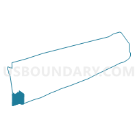
Outline

Summary
| Unique Area Identifier | 637075 |
| Name | Voting District 0100130 |
| County | Suffolk County |
| State | New York |
| Area (square miles) | 69.25 |
| Land Area (square miles) | 7.72 |
| Water Area (square miles) | 61.53 |
| % of Land Area | 11.15 |
| % of Water Area | 88.85 |
| Latitude of the Internal Point | 40.63316570 |
| Longtitude of the Internal Point | -73.34610300 |
Maps


Graphs
Select a template below for downloading or customizing gragh for Voting District 0100130, Suffolk County, New York


Neighbors
Neighoring Voting District (by Name) Neighboring Voting District on the Map
- Voting District 0100008 0100063, Suffolk County, NY
- Voting District 0100012, Suffolk County, NY
- Voting District 0100013, Suffolk County, NY
- Voting District 0100017, Suffolk County, NY
- Voting District 0100023, Suffolk County, NY
- Voting District 0100026, Suffolk County, NY
- Voting District 0100030, Suffolk County, NY
- Voting District 0100037, Suffolk County, NY
- Voting District 0100051, Suffolk County, NY
- Voting District 0100061, Suffolk County, NY
- Voting District 0100064, Suffolk County, NY
- Voting District 0100066, Suffolk County, NY
- Voting District 0100075, Suffolk County, NY
- Voting District 0100096, Suffolk County, NY
- Voting District 0100102, Suffolk County, NY
- Voting District 0100114, Suffolk County, NY
- Voting District 0100119, Suffolk County, NY
- Voting District 0100121, Suffolk County, NY
- Voting District 0100122, Suffolk County, NY
- Voting District 0100142, Suffolk County, NY
- Voting District 0100146, Suffolk County, NY
- Voting District 0500008, Suffolk County, NY
- Voting District 0512067, Nassau County, NY
- Voting District 0512078, Nassau County, NY
Top 10 Neighboring County Subdivision (by Population) Neighboring County Subdivision on the Map
- Islip town, Suffolk County, NY (335,543)
- Oyster Bay town, Nassau County, NY (293,214)
- Babylon town, Suffolk County, NY (213,603)
Top 10 Neighboring Place (by Population) Neighboring Place on the Map
- West Babylon CDP, NY (43,213)
- West Islip CDP, NY (28,335)
- Lindenhurst village, NY (27,253)
- Copiague CDP, NY (22,993)
- East Massapequa CDP, NY (19,069)
- Babylon village, NY (12,166)
- Amityville village, NY (9,523)
- Fire Island CDP, NY (292)
- Oak Beach-Captree CDP, NY (286)
- Gilgo CDP, NY (131)
Top 10 Neighboring Unified School District (by Population) Neighboring Unified School District on the Map
- Massapequa Union Free School District, NY (47,145)
- Lindenhurst Union Free School District, NY (42,011)
- Copiague Union Free School District, NY (30,505)
- West Islip Union Free School District, NY (28,042)
- West Babylon Union Free School District, NY (27,918)
- Amityville Union Free School District, NY (26,210)
- Babylon Union Free School District, NY (11,797)
- Fire Island Union Free School District, NY (408)
Top 10 Neighboring State Legislative District Lower Chamber (by Population) Neighboring State Legislative District Lower Chamber on the Map
- Assembly District 11, NY (135,087)
- Assembly District 5, NY (131,677)
- Assembly District 8, NY (128,281)
- Assembly District 12, NY (126,438)
Top 10 Neighboring State Legislative District Upper Chamber (by Population) Neighboring State Legislative District Upper Chamber on the Map
Top 10 Neighboring 111th Congressional District (by Population) Neighboring 111th Congressional District on the Map
Top 10 Neighboring Census Tract (by Population) Neighboring Census Tract on the Map
- Census Tract 1237.02, Suffolk County, NY (8,167)
- Census Tract 5220, Nassau County, NY (6,919)
- Census Tract 1242, Suffolk County, NY (6,251)
- Census Tract 1235, Suffolk County, NY (5,905)
- Census Tract 5219.02, Nassau County, NY (4,559)
- Census Tract 1246.02, Suffolk County, NY (4,340)
- Census Tract 1469.02, Suffolk County, NY (4,293)
- Census Tract 1238.01, Suffolk County, NY (4,158)
- Census Tract 1244.01, Suffolk County, NY (3,889)
- Census Tract 1244.02, Suffolk County, NY (3,808)
Top 10 Neighboring 5-Digit ZIP Code Tabulation Area (by Population) Neighboring 5-Digit ZIP Code Tabulation Area on the Map
- 11706, NY (62,543)
- 11758, NY (53,804)
- 11757, NY (45,700)
- 11704, NY (40,222)
- 11701, NY (27,109)
- 11795, NY (26,030)
- 11726, NY (19,857)
- 11702, NY (14,498)